, bringing its South China Sea maritime rights claims into closer alignment with UNCLOS.
The authoritative statement of the Chinese government, released in direct response to the arbitration, strongly implied that China does not in fact claim historic rights over the whole area of the nine-dash line. Such an expansionist reading of the nine-dash line was never an official policy position. But it has underpinned a great deal of the most worrying Chinese behaviour in the South China Sea, especially its program of patrols and coercive actions along the outer edge of the nine-dash line.
The implied claim to ‘historic rights’ across the nine-dash line area was also the subject of one of the arbitral tribunal’s major findings against China.
The Chinese government’s statement contained five numbered points, each explaining a different aspect of China’s position. It restated China’s historical claim to territorial sovereignty and ‘relevant rights and interests’ over islands in the South China Sea, and reemphasised the government’s actions to uphold said sovereign rights and interests since 1949.
It also disaggregated four elements of China’s rights and interests in the South China Sea: sovereignty over its claimed islands in the South China Sea; territorial seas and contiguous zones based on those islands; exclusive economic zone (EEZ) and continental shelf rights derived from those islands; and other historic rights.
Finally, it reiterated China’s opposition to other countries’ occupation of some of the Spratlys, and voiced China’s commitment to freedom of navigation for international shipping.
This was, as far as I know, the most comprehensive encapsulation of China’s claims ever made in an official document. None of the elements are new, but they have probably never appeared side-by-side in one document before (and certainly not with this level of authority). The claim to ‘historic rights’, for example, is included in China’s 1998 EEZ and Continental Shelf law, but that document does not refer to the nine-dash line. A diplomatic note to the UN in 2009 included the nine-dash-line map for the first time officially, but didn’t mention historic rights. And another 2011 note to the UN specified that the Spratlys were entitled to an EEZ and continental shelf, but didn’t include the nine-dash-line map or ‘historic rights’.
The new statement puts all of these elements together, but its construction clearly separates the nine-dash line from the claim to ‘historic rights’ and other maritime rights claims. In the section on China’s territorial claims it explains that the ‘dotted line’ map was published in 1948 with the purpose of ‘strengthen[ing] the administration over’ the Chinese-claimed islands in the South China Sea. It makes no mention of ‘historic rights’.
The omission of a link between the nine-dash line and China’s ‘historic rights’ wouldn’t on its own mean much if they weren’t mentioned elsewhere in the statement. But they are: they appear on the list of four elements that comprise China’s maritime claims, where they are once again listed separately from the territorial claims to sovereignty over islands.
By referring to the nine-dash-line map as evidence of China’s territorial sovereignty over islands — but not linking it to the EEZ, continental shelf and ‘historic rights’ it also discussed — the statement effectively decoupled the map from China’s maritime rights claims in the area. The implicit link between the two was the basis of one of the tribunal’s major findings against China.
China’s White Paper on the South China Sea dispute released on the same day provides another authoritative, and even more detailed, statement of China’s claims in the South China Sea.
Perhaps its greatest significance is found in an extremely subtle piece of language: the designation of Nanhai Zhudao as the source of China’s EEZ and continental shelf claims. This phrase, meaning ‘the various islands of the South China Sea’ in Mandarin, was rendered in pinyin, rather than translated, in the English version.
The background is crucial. China explicitly claimed in a 2011 diplomatic note to the UN that the Nansha Qundao — that is, the Spratlys — are ‘fully entitled’ to an EEZ and continental shelf. It repeated this claim in its 2014 Position Paper on the arbitration. The White Paper, though, does not repeat this claim, instead citing Nanhai Zhudao, the collective term for all of China’s claimed offshore islands in the area, as the basis of its EEZ and continental shelf claims.
This tweak allows for a reading of China’s position that does not contradict the Tribunal’s finding that the Spratly Islands are rocks: the Nanhai Zhudao include the Paracel Islands and also the Pratas Islands, whose island or rock status the tribunal did not rule on.
Woody Island, the largest of the Paracels, is about 4–5 times bigger than Itu Aba, the biggest Spratly, as well as being located much closer to both Chinese and Vietnamese coastlines. For that reason it has probably been subject to a much more intensive human presence historically. It therefore may stand a better chance of avoiding the ‘rock incapable of sustaining human habitation’ designation, and sustaining an EEZ and continental shelf claim.
So even as the Party-state condemns the ruling as a ‘farce’ and loudly proclaims China’s non-acceptance, non-compliance and non-implementation, these subtle clarifications raise the possibility of a Chinese maritime rights claim in the South China Sea that looks something more like the UNCLOS-compliant one illustrated above.
Of course, this doesn’t imply Beijing will start drawing new lines on maps to make all these suggestions explicit — they will want to avoid precisely that kind of visual depictions of a backdown.
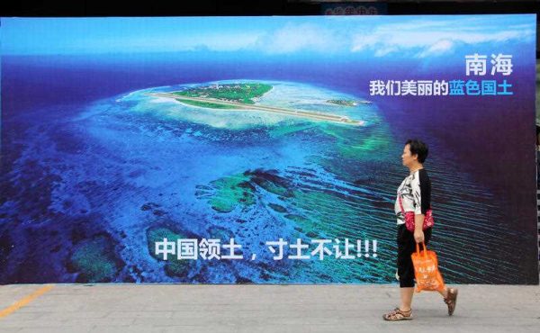
Chinese public opinion seems generally unaware of (and probably uninterested in) the difference between sovereignty and maritime rights. But the distinction is crucial because it’s overwhelmingly the enforcement of China’s maritime rights claims — not its territorial sovereignty claims — that have caused so much tension and concern since 2007.
Major Chinese news portals have all led with variations of the headline: ‘Xi Jinping says South China Sea Islands have always belonged to China’ — a statement that the UNCLOS-mandated tribunal did not in any way challenge. Driving attention towards this tough-sounding stance on territorial sovereignty provides good political cover for the quiet clarification of China’s maritime rights claims that may be underway.
Andrew Chubb is a PhD Candidate at the University of Western Australia. He is conducting research on nationalism and public opinion in Chinese foreign policy.
A good analysis. Here are my comments:
1 According to Dr Sam Bateman, a former Australian Naval Commodore with research interests in regimes for good order at sea, “the U-shaped line is a loose geographical shorthand to say we claim islands and features, it is not actually questioning other countries who have established exclusive economic zones inside the nine dash line, or indeed have maritime boundaries with their neighbor.”
As a signatory of Unclos, China can only claim a 12 nm territorial water and a 200 nm EEZ, plus a continental shelf if any exists. China cannot claim “most of the South China Sea” as often reported by the Western media. It is mathematically impossible.
2 Though the Tribunal has expunged the nine dash line from the map, a new dash line will surely emerge when the littoral states around the South China Sea get their acts together and agree to a new maritime delimitation line in the future.
3 What is disappointing is that the Tribunal conveniently ignored the historical fact that 7 years after Japan’s Unconditional Surrender, Japan handed Xisha (Paracel) and Nansha (Spratly) islands Japan annexed in 1939, back to the Republic of China under Article 2 of the Treaty of Peace on 28 April 1952, in accordance with the terms of the 1945 Potsdam Declaration.
http://www.taiwandocuments.org/taipei01.htm
In the Surrender Documents Japan pledged to “undertake for the Emperor, the Japanese Government and their successors to carry out the provisions of the Potsdam Declaration in good faith.”
Article 8 of the 1945 Potsdam Declaration stated unequivocally: “The terms of the Cairo Declaration shall be carried out.” And the 1943 Cairo Declaration, signed by the US, UK and China, was explicit: “Japan will also be expelled from ALL other territories which she has taken by violence and greed”.
4 Another disappointment is that the Tribunal chose to ignore the fact that in Nov 1978, President Ferdinand Marcos illegally annexed 8 features in China’s Spratly islands by issuing a Presidential decree 1596 and then named them the Kelayaan (Peace) Islands, even though that violated the UN Charter.
The United States never handed to an independent Philippines any island in the SCS in 1946 as none was handed to the US under the Treaty of Paris 1898 by Spain, after the American-Spanish war, in which the US emerged the winner and gained the Philippines as a colonial war booty.
Also, the 1898 Treaty of Paris, the 1900 Treaty of Washington and the 1930 Convention between the United States and Great Britain, described the western limit of the Philippine territory as 118 degrees East longitude.
The map shows that China’s Spratly and Paracel islands in the SCS, including Huangyan Dao (Scarborough shoal), are all west of that longitude.
5 When UNCLOS came into force in 1994, it did not award any littoral states with any island or reef as it has no such power to do so. This begs the question: On what basis did the Tribunal award the Philippines the ‘traditional’ rights to fish in the Scarborough shoal, which has a 12 nm territorial sea when the Tribunal never disputed China’s sovereignty?
For the Tribunal to declare that the Scarborough shoal lies in the EEZ of the Philippines is ultra vires, when China’s sovereignty has not been vitiated.
If by merely lying in the EEZ of the Philippines, the Tribunal implies that the Scarborough shoal belongs to the Philippines then the ridiculous argument follows that the Singapore island, which lies 3 mn from Malaysia’s southern EEZ shall belong to Malaysia. This is not the case.
6 Lastly, another disappointment is the Tribunal’s controversial ruling that Taiping island is a rock.
Taiping Island is about 46 ha in area and can sustain economic activity under Article 121 of Unclos, as it is the biggest land mass in the Spratlys, with plenty of fresh water.
It also has buildings, a hospital, a runway, harbour and marine research facilities, farming and fishing activities and a few hundred people living on it.
Taiping Island’s history goes back by 600 years, as recorded in the ‘Geng Lu Bu’ or Manual of Sea Routes.
The Philippines deceptively claimed Taiping Island is a high-tide rock and thus has no 200nm EEZ, which would extend even to the shores of the Philippines, vindicating the nine dash line.
The Tribunal, amazingly, agreed with the Philippines but did not explain how it was possible for an aircraft, carrying the Taiwanese President in 2015, was able to land on the 3,800 ft runway of a rock. Check out its size below:
http://english.cri.cn/12394/2016/06/03/3441s929762.htm
Hi KT,
Thanks for reading and commenting. A few notes on the points you raise:
1. You’re right that China can’t claim most of the SCS on the basis of UNCLOS-derived claims. The point, as noted by the Tribunal, is that numerous Chinese actions have strongly implied a claim to living and non-living resources out to the edges of the nine-dash line. See, for example the oil and gas blocks released in 2012 by CNOOC, or the locations of the Sino-Vietnamese “cable-cutting” incidents of 2011 and 2011.
2. I can’t see the PRC wanting new lines to be drawn on the map, within the nine-dash line while the Chinese domestic public is being told it’s their “blue-coloured territory”. Any agreement involving lines on a map would be vulnerable to condemnation as the “carving up of China’s territory”.
3. The arbitration proceeded “on the premise that China has sovereignty” (Award, para 153).
4. See 3.
5. Obviously, the arbitrators did not say the territory at Scarborough Shoal belongs to the Philippines because it’s located within its 200nm EEZ. In fact, as noted, the Tribunal proceeded on the assumption that China has sovereignty over Scarborough Shoal. The Award outlined clear evidence that it is a traditional fishing ground for fisherfolk not only from the Philippines, but also China, Vietnam and other countries. See Award paras. 792-815. Therefore, the tribunal concluded, even assuming it belongs to China, the PRC Coast Guard should not be preventing these traditional fishing activities.
6. The landing of aircraft has no bearing on the status of a feature as a “rock”. The reason Taiping and the entire Spratly archipelago were designated as “rocks incapable of sustaining human habitation” under Article 121.3 was because this article was added to the Convention for the specific purpose of preventing very large EEZ claims from very small islands with no permanent residents. You will find the details in the Award, paras 475-570.
Hi Andrew, thank you. Here is Part I of my response:
1 “The point, as noted by the Tribunal, is that numerous Chinese actions have strongly implied a claim to living and non-living resources out to the edges of the nine-dash line. ..”
Why only blame China? The 215 oil and gas blocks claimed by the Vietnamese Government in the South China Sea are sufficient to expose Hanoi’s ambitions for exclusive occupation of China’s seabed resources.
Today, “the crude oil reserves in Vietnam are the second largest in East Asia, behind China, with 4.4 billion barrels, or 630 million tons.”
http://www.oilgasvietnam.com/post/97/Industry-Facts.html
2.” Any agreement involving lines on a map would be vulnerable to condemnation as the “carving up of China’s territory”.
There were initially 11 dash lines drawn up by the ROC on 1 December 1947 and when it lost the civil, China adopted the 11 dash lines but decided to delete two dash lines when she reached an agreement with Vietnam over the Gulf of Tonkin.
If China reaches a maritime delimitation agreement each with say Malaysia, Indonesia and Brunei then I am sure at least 5 more dash lines would be deleted, leaving the maritime boundaries to be negotiated with Vietnam and the Philippines.
When the latter two are finalized (don’t hold your breath) then there will be no more need for any dash line as there will (be) official maritime boundaries in the South China Sea, with proper coordinates
3.“The arbitration proceeded “on the premise that China has sovereignty” (Award, para 153)”.
Thank you. If there is no dispute that China has sovereignty in the Spratly, Paracel islands and Scarborough shoal, then why is that Vietnam occupies 29 islands and reefs in the Spratlys since the 1970s and the Philippines occupies 8 features since 1978, with impunity?
It is therefore disappointing to note that the Tribunal ignored President Marcos’ annexation of 8 features in China’s Spratly islands in 1978, (including Second Thomas reef) and instead pillory China for allegedly preventing food supplies from reaching the rusty and crumbling navy ship, the Sierra Madre, where a bunch of marines are marooned after the Philippines navy deliberately grounded the ship on the Second Thomas reef and damaged the reef? Where is the equity?
Why did the Tribunal not rebuke the Philippines when according to Mr Alberto Encomienda, former secretary-general of Maritime and Ocean Affairs Center of the Philippine Foreign Affairs Department, the Philippines was “the first to do reclamation in South China Sea”?
“So we cannot demonize China for reclamation”, he said, revealing that the airfield on Zhongye Island “was built on top of live coral reefs”.
http://africa.chinadaily.com.cn/world/2016-06/11/content_25674742.htm
But instead China was castigated by the Tribunal for allegedly destroying coral reefs during the reclamation of islands, when the Filipino fishermen customarily used dynamites to stun the fish and destroy the coral reefs. Why is it good for the goose but not good for the gander?
4. “See 3”.
If under Article 2 of the Treaty of Peace, it is deemed that Japan had returned the Spratly islands to China, then IMHO, the tribunal was wrong to declare that Mischief, Subi, Gaven, Second Thomas reefs lie in the EEZ of the Philippines when no delimitation has yet been agreed by the two parties, as required under the provisions of Unclos.
It also implies that the Philippines has sovereignty over these reefs which is not true.
This only adds fuel to the fire when the tribunal’s job is supposed to help parties settle the disputes expeditiously.
Andrew, here is Part II:
5.“In fact, as noted, the Tribunal proceeded on the assumption that China has sovereignty over Scarborough Shoal.”
Assumptions are not allowed. The Tribunal must base its ruling only on admissible evidence. China has sovereignty over the Scarborough shoal and did not grab it from the Philippines in 2012 and some western media seem to claim.
The 1898 Treaty of Paris, the 1900 Treaty of Washington and the 1930 Convention between the United States and Great Britain, described the western limit of the Philippine territory as 118 degrees East longitude. China’s Scarborough shoal is located West of that longitude.
5 (a) “The Award outlined clear evidence that it is a traditional fishing ground for fisherfolk not only from the Philippines, but also China, Vietnam etc..”
Since the Tribunal ruled that Scarborough shoal has a 12nm territorial sea, then China has sovereignty over it and under Article 19, 2 (i) it is illegal for a foreign ship to engage in fishing activities therein.
But the Tribunal not only ruled the Filipino fishermen have ‘traditional fishing rights’ inside the 12 nm mile territorial sea of the Scarborough shoal, it also extended that same rights to Vietnamese fishermen, 280 nm from home, when no such request was made.
And if China’s historical rights inside the nine dash line were extinguished when Unclos come into force in 1994, why did China bother even to ratify Unclos it in 1996 or even want to remain as a member now?
“The tribunal has no such general authority to retroactively extinguish historical rights claims of sovereign nations that pre-existed UNCLOS” says author Joseph A Klein:
http://canadafreepress.com/article/un-law-of-the-sea-arbitration-tribunal-sinks-the-rule-of-law
6.“The reason Taiping and the entire Spratly archipelago were designated as “rocks incapable of sustaining human habitation” under Article 121.3 was….”
But the original drafter’s intentions were very clear. Article 121(3) of Unclos states simply that, “rocks which cannot sustain human habitation or economic life of their own shall have no exclusive economic zone or continental shelf”.
Taiping Island is a naturally-formed island with an area of 46 ha and it can ‘sustain human habitation or economic life’ on its own as it has plenty of fresh water, farmland, fruits and vegetable gardens, coconut trees, livestock, huge supplies of fish stock and it has a meteorological station plus over 200 people.
See the Taiwan’s Press Release here:
http://www.mofa.gov.tw/en/News_Content.aspx?n=8157691CA2AA32F8&sms=4F8ED5441E33EA7B&s=174B7FC38E9C9F9B
Since Taiwan has control over Taiping island the Tribunal should have consulted Taiwan but it did not. This is troubling.
Former ICJ judge Karoma said that such a pivotal decision takes years to make, after lengthy consultations with UN Commission on the Limits of the Continental Shelf and after surveys, checking with ancient maps, etc, which only took months in the case.
The way the Tribunal micro-managed every single word of Article 121(3) it will also come to the absurd conclusion that under its cavalier interpretation even Singapore island is a rock because though it has a population of 5.4 million and 277.6 sq mi in land area, it cannot be called an island as it “cannot sustain human habitation or economic life” of its own, because Singapore imports most of its raw water from Malaysia every day and imports almost all the food needed. But if it is rock, how can it have the highest per capita reserves in the world and one of the highest per capita GDP?
Professor Myron Nordquist from the University of Virginia poured scorn on the Tribunal’s ruling that Taiping Island is a rock and said it made a “huge mistake”. He was attending the Public International Law Colloquium on Maritime Dispute Settlement, in Hong Kong on July 15.
Stephane Dujarric, spokesman for UN Secretary-General Ban Ki-moon said on 12 July, “The UN doesn’t have a position on the legal and procedural merits of the South China Sea arbitration case.”
Vietnam’s Prime Minister Nguyen Xuan Phuc said his nation respects China’s position on the arbitration, adding the disputes should be solved peacefully through negotiations.
Russia opposes the internationalization of the South China Sea disputes or any interference by forces outside the region, said PM Dmitry Medvedev.
Unintended consequences of the Taiping Island ruling:
1 Japan’s Okinotorishima, an uninhibited rock and part-submerged atoll a 1,000 miles south of Tokyo, will no longer have a 200 nm EEZ.
2 The US-controlled Baker and Howland islands in the South Pacific, which are uninhabited, with no fresh water and are now bird sanctuaries, will also no longer have a 200nm EEZ.
3 Indonesia’s Natuna islands may now not have a 200 nm EEZ too.
4 Lastly, there is Woody island in the Paracel islands. With a land area of 210ha, it is the largest contiguous land area in the SCS. In July 2012, China established Sansha city, with its seat of government on Woody Island, to administer the Paracel, Pratas, Macclesfield banks & Scarborough shoal and the Spratly islands.
It has a population of about 1,400, administrative and residential buildings, a hospital, hostels, a post office, cafes, markets, stores, research center, a harbor and an airport capable of handling narrow-bodied airliners and military jets.
Since it is located inside the nine dash line, did the Tribunal also rule that it is also a rock without a 200nm EEZ? If so, it flies in the face of logic.
Erratum:
Item 5 Para 2, 3rd sentence should read like this “China has sovereignty over the Scarborough shoal and did not grab it from the Philippines in 2012 as some western media seem to claim.”
Thank you.
There seems to be quite a lot of factual errors upon which you are basing your arguments and apparent conclusions, KTT.
Just a few examples:
You claim that, “Japan handed Xisha (Paracel) and Nansha (Spratly) islands Japan annexed in 1939, back to the Republic of China under Article 2 of the Treaty of Peace on 28 April 1952”
A copy of the document freely is available as pdf from the treaties dot un dot org website and simply does not support what you wrote, saying instead:
“It is recognized that under Article 2 of the Treaty of Peace with Japan signed at the city of San Francisco in the United States of America on September 8, 1951 (hereinafter referred to as the San Francisco Treaty), Japan has renounced all right, title and claim to Taiwan (Formosa) and Penghu (the
Pescadores) as well as the Spratly Islands and the Paracel Islands.”
So clearly, Japan had renounced all right, title and claim to Taiwan AND the Pescadores AS WELL as the Spratlys AND Paracels. But did not “hand over” the Pescadores, Spratlys and Paracels TO Taiwan, as you claim.
You also seem have made arguments based on the erroneous assumption that the Philippines was a signatory of the 1898 Treaty of Paris, the 1900 Treaty of Washington and the 1930 Convention between the US and UK, and should somehow still abide by these documents.
If the Philippines did this, it would actually enlarge its territorial sea much farther out, beyond the 12-nautical mile limit set by UNCLOS.
But more importantly, you seem to ignore the fact that the Philippines have long replaced its 1935 Commonwealth Constitution, which did feature the boundaries set by the Treaty of Paris, and have long since enacted its Republic Act (RA) 9522 Baselines Law, which places its maritime territorial boundaries in line with UNCLOS.
You also seem to have assumed as true, the outlandish rumour that the Treaty of Paris or Treaty of Washington or Convention between the US and UK actually placed the “western limit of the Philippine territory at 118 degrees East longitude.”
This is of course, a complete fallacy.
A copy of the 1898 Treaty of Paris and 1900 Treaty of Washington can be accessed on the avalon dot law dot yale dot edu website.
Anyone can also Google the treaties and convention that you tried to cite, albeit not very precisely, to find for themselves that none of them placed the “western limit of the Philippine territory as 118 degrees East longitude.”
Yes, the 118th meridian east was mentioned a number of times, though not as the “western limit of the Philippine territory,” but rather as belonging to a set of coordinates creating a polyline running east-west and north-south and diagonally off the archipelago, going as far west as the 116th meridian east.
Anyone with the most basic knowledge of cartography would have easily realized that if the western limit if Philippine territory was the 118th meridian east, this would cut the Philippine island of Palawan in half. Anyone can Google 118th meridian east to verify this for themselves.
It should also be remembered that the 1900 Treaty of Washington explicitly provided that: “Spain relinquishes to the United States all title and claim of title; which she may have had at the time of the conclusion of the Treaty of Peace of Paris, to any and all islands belonging to the Philippine Archipelago, lying outside the lines described in Article III of that Treaty,” thereby increasing the amount of Philippine territorial sea than previously described in 1898.
So are you actually arguing that the Philippines should be entitled to even more territorial seas than what has been set in UNCLOS?
You also somehow assert that the Philippines’ annexation of the Kalayaan islands was illegal because, as you claim, the Kalayaan islands were not included in the Treaty of Paris. This is a non sequitur in which you again assert your 118th meridian east argument, as if it was fact.
The above are just a few examples of the many fallacies that abound in your rather long posts. Readers would therefore be very well advised to check the veracity of the rest of your supposed “facts.”
Thank you.
Thank you. Here is Part 1 of my response:
You say that Japan did not “hand over” the Spratlys and Paracels TO Taiwan”.
But the Treaty of Peace signed by Japan with the ROC on 28 April 1952 fixed that. Article 2 stated clearly:
“It is recognised that under Article 2 of the Treaty of Peace which Japan signed at the city of San Francisco on 8 September 1951 (hereinafter referred to as the San Francisco Treaty), Japan has renounced all right, title, and claim to Taiwan (Formosa) and Penghu (the Pescadores) as well as the Spratley Islands and the Paracel Islands.”
http://www.taiwandocuments.org/taipei01.htm
Everyone knows Taiwan and the Pescadores have already been returned to the Republic of China (Taiwan).
If Japan had no intention to return the Spratly and Paracel islands to the ROC, why bothered to add that they renounced as well “the Spratley Islands and the Paracel Islands.”
Why not leave that out of the Treaty of Peace with the ROC, altogether?
But some commentators like you still claim that only Taiwan and the Pescadores were returned to the ROC and the Spratly and Paracel are Terra Nullius. This is flawed.
If they care to study history more deeply they will understand that in the Surrender Documents, signed by Japan on 2 September 1945, it stated that Japan “undertakes for the Emperor, the Japanese Government and their successors to carry out the provisions of the Potsdam Declaration in good faith.”
Article 8 of the 1945 Potsdam Declaration stated unequivocally: “The terms of the Cairo Declaration shall be carried out.”
And the 1943 Cairo Declaration was explicit: “Japan will also be expelled from ALL other territories which she has taken by violence and greed”.
Japan took over Formosa and the Pescadores by force as war booty and legitimized it under the sham Treaty of Shimonosecki in 1895 and they became colonies of Japan. They were returned to the ROC on 28 April 1952.
Japan invaded China in July 1937. The French took advantage of the fog of war and invaded the Spratly and the Paracel islands on 3 July 1938.
But on 1 March 1939 Japan invaded and colonized the Spratly and Paracel islands and summarily evicted the French.
When Vichy France (aligned with Nazi Germany) protested, Japan reasoned that it was wartime and Japan could annex China’s territories, NOT Philippines’s territories.
After Japan’s unconditional surrender, under the terms of the Potsdam Declaration, Japan returned Formosa and the Pescadores AS WELL AS the Paracel and Spratly islands to the Republic of China in the Treaty of Peace on 28 April 1952.
Since the Philippines, US, Japan, Australia and other 9 Asean nations abide by the one-China policy, that Taiwan is a part of China, then by extension, the Spratly and Paracel islands have been returned to their rightly owner, China, on 28 April 1952.
On 4 Sept 1958, China issued a Declaration that henceforth her territorial seas would be 12 nm, and that specified that that included the territorial seas in the Spratly and Paracel islands.
The Declaration was printed on the front page of the Nhan Dan in Hanoi.
The Philippines, US, Japan, Australia, North Vietnam, France, Malaysia, the Philippines, Brunei did not raise any objection. Why now?
In fact, on 14 Sept, Mr Pham Van Dong, the Prime Minister of North Vietnam, wrote a letter to Premier Zhou En Lai and stated unequivocally “We have the honour to bring to your knowledge that the Government of the DRVN recognizes and supports the declaration dated 4th September, 1958 of the Government of the PRC fixing the width of the Chinese territorial waters…”.
Later, he tried to vitiate his actions in the 16 March 1979 issue of the now defunct, Dow Jones-owned, Far Eastern Economic Review, by stating that he did what he did because it was ‘wartime’.
But it was already on record that Mr Pham had stated on *15 June 1956*, to wit: “From (a) historical point of view, these islands (Spratlys and Paracels) are Chinese territories”, as disclosed in the same issue of the Far Eastern Economic Review.
On 15 June 1956, North Vietnam’s Vice Foreign Minister Ung Van Khiem also said “according to Vietnamese data, Xisha (Paracel) and Nansha (Spratly) Islands are historically part of Chinese territory”.
The Acting Director of the Asian Department, Le Loc added, “judging from history, these islands were already part of China at the time of the Song Dynasty.”
The US never handed to the Philippines any islands in the Spratly in 1946 and Unclos has no power to award the Philippines with any islands there.
So Mat E, how did the Philippines come to claim the islands in the Spratly?
@KTTAN
You’ve just used the same Treaty of Peace that I did, but somehow came away with a gross misunderstanding that the document somehow stated Japan handed the Pescadores and the Spratlys TO Taiwan, when it simply does not say that at all:
“It is recognised that under Article 2 of the Treaty of Peace which Japan signed at the city of San Francisco on 8 September 1951 (hereinafter referred to as the San Francisco Treaty), Japan has renounced all right, title, and claim to Taiwan (Formosa) and Penghu (the Pescadores) as well as the Spratley Islands and the Paracel Islands.”
As to the Philippines claim to the Spratlys,
it really is quite irrelevant to the case filed with the PCA Tribunal because the case was NOT about sovereignty claims to the Spratlys, but rather it was about the violation of one country’s UNCLOS rights by another signatory.
The PCA tribunal had to decide if China had any legal or historical basis to go into the Philippines’ EEZ, violating the Philippines’ UNCLOS rights.
Now, if China truly thinks that the Philippines’ claims to the Spratlys are illegal then it should be China that should be suing the Philippines in international court, such as the ICJ.
Beijing’s bizarre refusal to do so only shows how little faith it has in any true historical evidence to support its case in any international court.
This is most likely why China would prefer to bombard online comments sections, instead of submitting a solid case before an international court: China does not have a solid case that can pass the scrutiny of an international court whereas it can sound impressive in comments sections that do not really solve anything.
1 If you still have any doubt that Japan had transferred Formosa, Pescadores well as the Spratly and Paracel Islands back to the ROC and by extension to China, the text of the Cairo Conference statement made by President Roosevelt, Generalissimo Chiang Kai-shek and Prime Minister Churchill in Nov 1943 was very clear:
“The three great Allies are fighting this war to restrain and punish the aggression of Japan. They covet no gain for themselves and have no thought of territorial expansions. It is their purpose that Japan shall be stripped of all the islands in the Pacific which she has seized or occupied since the beginning of the first World War in 1914, and that ALL the territories Japan has stolen from the Chinese, such as Manchuria, Formosa [Taiwan], and the Pescadores, shall be restored to the Republic of China. Japan will also be expelled from ALL other territories which she has taken by violence and greed.” (Emphasis mine).
2 In case, you still wish to argue that the Spratly and Paracel islands were not mentioned, the Cairo Conference statement was very specific :
“that ALL the territories Japan has stolen from the Chinese,.. shall be restored to the Republic of China.”
Who stole the Spratly and Paracel Islands from China in 1939? Japan.
3 In 1933 the Philippines, as a US colony, wanted to annex the Spratly islands but US Secretary of States Cordell Hull officially replied in writing to Secretary of war George Dern, on 20 August 1933, stating that, “the islands of the Philippine group which the United States acquired from Spain by the treaty of 1898, were only those within the limits described in Article III”, and that, referring to the relevant Spratly islands, “It may be observed that […] no mention has been found of Spain having exercised sovereignty over, or having laid claim to, any of these islands”.
4 The Tribunal was able to state that China’s nine dash line violated the EEZ of the Philippines because it arbitrarily turned Taiping Island into a Rock but never explained how a large transport plane, carrying the Taiwan President, could land there in 2015.
5 Lawfare cannot solve sovereignty or delimitation problems. Ask President Rodrigo Duterte. He is a lawyer and he is a lot smarter that you. That is why he sent Ramos to mend the fences in Hong Kong this week.
The PRC reportedly blamed Japan for the recent decision against its interests by claiming that Japanese director nominated four other Japanese nationals to sit on the Tribunal. Therefore, of course, the ruling went against Chinese wishes.
What a country’s government says about an issue if noteworthy, to be sure. But what it actually does, or continues do, is even more relevant. We shall see how the Chinese act in the wake of this ruling, etc in the weeks to come. Its true intentions will become apparent via its behavior.
@ Richard,
It looks like you are confused and I don’t blame you as some journalists, who are members of the 4th Estate, are confused too.
Please allow me to walk you through the recent events:
1 The paradox is that the Permanent Court of Arbitration (PCA) at the Hague is NOT a court at all and it has no sitting judges or any links to the United Nations. It is not UN-backed as some media claimed. The PCA provides a private administrative facility for two parties to settle disputes. China was not a party.
2 The PCA, established in 1899, writes on its official website that “unlike the International Court of Justice,(ICJ) “the Permanent Court of Arbitration “has no sitting judges” and its sessions “are held in private and are confidential.”
This shows it lacks transparency.
3 The International Court of Justice (ICJ), created in 1946, is an organ of the United Nations, which can also settle the disputes between two countries.
4 The confusion arises because both the ICJ and the PCA are located at the Peace Palace in the Netherlands. The UN spokesman said the PCA is a “tenant” of the Peace Palace in the Hague, “but has nothing to do with the UN”.
5 The Philippines chose the PCA in 2013, because it is an ad hoc private tribunal, which was arranged by the International Tribunal of the law of the Sea (ITLOS), based in Germany, whose president from 2011 to 2014 was Mr Shunji Yanai, a retired Japanese Ambassador to the United States.
He selected four arbitrators (no Japanese at all) while the Philippines selected one.
All of the Philippines’ lawyers were Americans, with two silks from the UK. It was reported that the Philippines paid US$30 million for the private arbitration.
6 Mr Yanai should have recused himself as Japan and China have disputes over the Diaoyu/Senkaku islands but he did not and this is the controversy that is wagging tongues all over the world.
7 A Sri Lanka judge was first appointed by Mr Yanai to act as Chairman of the five-member ad hoc Tribunal but he turned down the multi-million euro offer, as his dear wife is from the Philippines. That is the right and honourable thing to do for a reputable judge.
8 Stephane Dujarric, spokesman for UN Secretary-General Ban Ki-moon said on 12 July, “The UN doesn’t have a position on the legal and procedural merits of the South China Sea arbitration case.”
9 Meanwhile, Philippine president Rodrigo Duterte has asked former president Fidel Ramos to act as the envoy, to go to China to hold talks.
10 China welcomes president Duterte’s willingness to send an envoy for the talks because China adheres to its policies to resolve the issues through bilateral talks and has never shut the door for dialogue with the Philippines.
11 China’s FM spokesman said that “As along as China and the Philippines work to solve disputes through dialogue, we can lay a solid foundation for future relations.”
12 The good news is that when the two countries hold talks to resolve the disputes in the South China Sea, the Tribunal’s cavalier ruling of 12 July will be no more than just a little storm in a teacup.
You may not know it but whatever emanates from the CCP, and China as a whole for that matter, is constantly subject to change and fluctuation but this does not include their stance on the ownership or sovereignty, if you will, of those islands or rocks in the South China sea and elsewhere. Whatever inference you may gather from what you hear or see has no bearing on whether the CCP, be it Xi JinPing or another, has any inclination to acquiesce or give up their quest to take those islands in question. “contained welcome hints that China may be subtly, and under cover of a strong stance on its South China Sea territorial sovereignty, bringing its South China Sea maritime rights claims into line with UNCLOS.” This statement is in fact superfluous. The CCP and the Chinese people who live under it’s banner, on the whole, do not follow conventions, something you undoubtedly are unaware of. The dashed line is in fact just a ruse, an arbitrary line drawn up by the CCP and therefore it goes to show that yourself and many others have taken the bait and wasted their time discussing it.
Just for the Nine Dash Line, you state that it is an arbitrary line drawn up by the CCP. Is it true that the it was drawn up firstly by the CCP? It seems that China has been saying it was drawn before 1949, by the then Chinese government that was not CCP.